![](/images/other/stat-length.png)
![Excursión A pie Alto Reno Terme - IT-145 - Photo](https://media.geolcdn.com/t/1900/400/ext.pjpeg?maxdim=2&url=https%3A%2F%2Fmedia.geolcdn.com%2Ff%2F079bc68d-d89b-4e9f-a559-5b432440ed95.jpeg)
IT-145
SityTrail - itinéraires balisés pédestres
Tous les sentiers balisés d’Europe PRO
![Longitud](/images/other/stat-length.png)
Longitud
3,4 km
![Altitud máxima](https://static1.geolcdn.com/siteimages/upload/files/1508320355ic_sort_altitude_max_24dp.png)
Altitud máxima
1355 m
![Desnivel positivo](https://static1.geolcdn.com/siteimages/upload/files/1508320355ic_sort_den_pos_24dp.png)
Desnivel positivo
617 m
![Km-Effort](/images/other/stat-length.png)
Km-Effort
9,7 km
![Altitud mínima](https://static1.geolcdn.com/siteimages/upload/files/1508320355ic_sort_altitude_min_24dp.png)
Altitud mínima
744 m
![Desnivel negativo](https://static1.geolcdn.com/siteimages/upload/files/1508320355ic_sort_den_neg_24dp.png)
Desnivel negativo
13 m
![Boucle](https://static1.geolcdn.com/siteimages/upload/files/16400158638029165_repeat_loop_refresh_sync_direction_icon.png)
Boucle
No
Baliza
Fecha de creación :
2022-02-15 12:49:38.769
Última modificación :
2022-03-01 10:37:20.297
![A pie](https://static1.geolcdn.com/sitytour/trail-icons/100.png)
2h11
Dificultad : Fácil
![Escanee este código QR para abrir la excursión en la aplicación SityTrail](https://capi.geolives.com/qq0zvz2zws4bq2lad0pu/sitytour/trails/3118822/qr.png?size=200)
Aplicación GPS de excursión GRATIS
A propósito
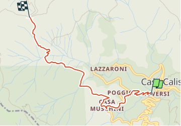
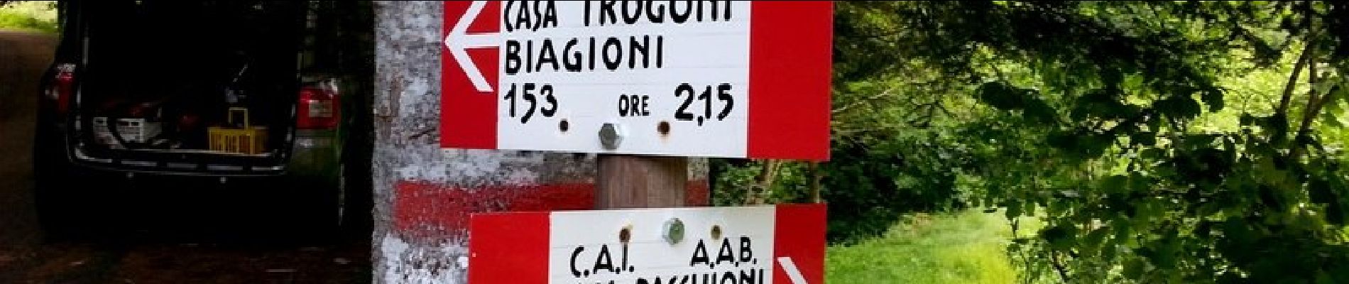
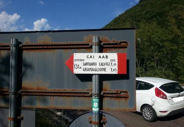
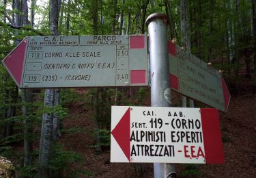
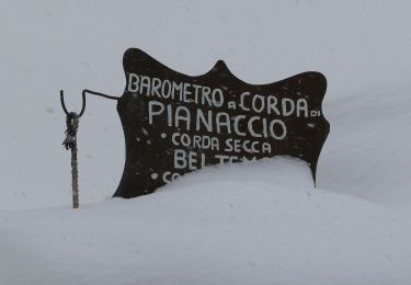
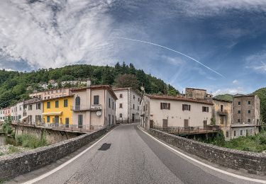
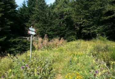
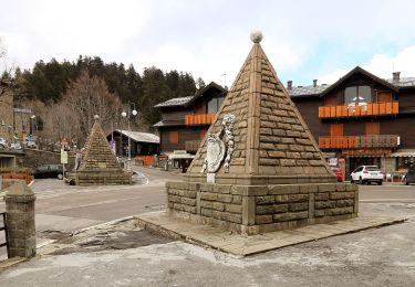
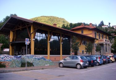
Ruta A pie de 3,4 km a descubrir en Emilia-Romaña, Bologna, Alto Reno Terme. Esta ruta ha sido propuesta por SityTrail - itinéraires balisés pédestres.
Descripción
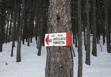
Trail created by CAI Porretta Terme.
Sitio web: http://www.caiporretta.it/
Localización
País:
Italy
Región :
Emilia-Romaña
Departamento/provincia :
Bologna
Municipio :
Alto Reno Terme
Localidad:
Unknown
Salida:(Dec)
Salida:(UTM)
652816 ; 4884429 (32T) N.
Comentarios
Excursiones cerca
![Excursión A pie Sambuca Pistoiese - IT-155 - Photo](https://media.geolcdn.com/t/375/260/ext.jpg?maxdim=2&url=https%3A%2F%2Fmedia.geolcdn.com%2Ff%2Ff18391dd-e81a-4b41-bb8f-708f9e311b13.jpeg)
![A pie A pie](https://static1.geolcdn.com/sitytour/trail-icons/100.png)
IT-155
A pie
Muy difícil
Sambuca Pistoiese,
Toscana,
Pistoia,
Italy
![](/images/other/stat-length.png)
26 km | 47 km-effort
10h 42min
![](https://static1.geolcdn.com/siteimages/upload/files/16400158638029165_repeat_loop_refresh_sync_direction_icon.png)
No
![Excursión A pie Lizzano in Belvedere - IT-113 - Photo](https://media.geolcdn.com/t/375/260/ext.jpg?maxdim=2&url=https%3A%2F%2Fmedia.geolcdn.com%2Ff%2Fa8597778-b81e-45f7-943b-ba303c908cd2.jpeg)
![A pie A pie](https://static1.geolcdn.com/sitytour/trail-icons/100.png)
IT-113
A pie
Fácil
Lizzano in Belvedere,
Emilia-Romaña,
Bologna,
Italy
![](/images/other/stat-length.png)
5,1 km | 8,2 km-effort
1h 51min
![](https://static1.geolcdn.com/siteimages/upload/files/16400158638029165_repeat_loop_refresh_sync_direction_icon.png)
No
![Excursión A pie Lizzano in Belvedere - IT-111 - Photo](https://media.geolcdn.com/t/375/260/ext.jpg?maxdim=2&url=https%3A%2F%2Fmedia.geolcdn.com%2Ff%2Fc3f8cb54-57a9-43bc-9a27-b0b7fdd56463.jpeg)
![A pie A pie](https://static1.geolcdn.com/sitytour/trail-icons/100.png)
IT-111
A pie
Fácil
Lizzano in Belvedere,
Emilia-Romaña,
Bologna,
Italy
![](/images/other/stat-length.png)
7,4 km | 17,5 km-effort
3h 58min
![](https://static1.geolcdn.com/siteimages/upload/files/16400158638029165_repeat_loop_refresh_sync_direction_icon.png)
No
![Excursión A pie Pistoia - (SI L13) Pracchia - Lago Scaffaiolo - Photo](https://media.geolcdn.com/t/375/260/ext.jpg?maxdim=2&url=https%3A%2F%2Fmedia.geolcdn.com%2Ff%2F0f01b9d8-449a-4075-bdb2-32152f2e40dd.jpeg)
![A pie A pie](https://static1.geolcdn.com/sitytour/trail-icons/100.png)
(SI L13) Pracchia - Lago Scaffaiolo
A pie
Medio
Pistoia,
Toscana,
Pistoia,
Italy
![](/images/other/stat-length.png)
14,8 km | 30 km-effort
6h 47min
![](https://static1.geolcdn.com/siteimages/upload/files/16400158638029165_repeat_loop_refresh_sync_direction_icon.png)
No
![Excursión A pie Alto Reno Terme - IT-199 - Photo](https://media.geolcdn.com/t/375/260/ext.jpg?maxdim=2&url=https%3A%2F%2Fmedia.geolcdn.com%2Ff%2F837c7b1e-4426-4052-bd2b-49b56b8e1396.jpeg)
![A pie A pie](https://static1.geolcdn.com/sitytour/trail-icons/100.png)
IT-199
A pie
Fácil
Alto Reno Terme,
Emilia-Romaña,
Bologna,
Italy
![](/images/other/stat-length.png)
5,1 km | 13,1 km-effort
2h 58min
![](https://static1.geolcdn.com/siteimages/upload/files/16400158638029165_repeat_loop_refresh_sync_direction_icon.png)
No
![Excursión A pie Pistoia - Itinerario Pracchia-Abetone - Photo](https://media.geolcdn.com/t/375/260/ext.jpg?maxdim=2&url=https%3A%2F%2Fmedia.geolcdn.com%2Ff%2Fe45850ca-9d49-4aba-bfa8-b4751d84c6db.jpeg)
![A pie A pie](https://static1.geolcdn.com/sitytour/trail-icons/100.png)
Itinerario Pracchia-Abetone
A pie
Muy difícil
Pistoia,
Toscana,
Pistoia,
Italy
![](/images/other/stat-length.png)
53 km | 81 km-effort
18h 18min
![](https://static1.geolcdn.com/siteimages/upload/files/16400158638029165_repeat_loop_refresh_sync_direction_icon.png)
No
![Excursión A pie San Marcello Piteglio - CAI 1 PT - Maresca - Maceglia - Photo](https://media.geolcdn.com/t/375/260/ext.jpg?maxdim=2&url=https%3A%2F%2Fmedia.geolcdn.com%2Ff%2F5971676b-e756-4d4b-bda8-f4f8638d99ce.jpeg)
![A pie A pie](https://static1.geolcdn.com/sitytour/trail-icons/100.png)
CAI 1 PT - Maresca - Maceglia
A pie
Fácil
San Marcello Piteglio,
Toscana,
Pistoia,
Italy
![](/images/other/stat-length.png)
4 km | 10,4 km-effort
2h 21min
![](https://static1.geolcdn.com/siteimages/upload/files/16400158638029165_repeat_loop_refresh_sync_direction_icon.png)
No
![Excursión A pie Alto Reno Terme - IT-147 - Photo](https://media.geolcdn.com/t/375/260/ext.jpg?maxdim=2&url=https%3A%2F%2Fmedia.geolcdn.com%2Ff%2Fb16ec1af-9c57-4209-a326-f43f651fb329.jpeg)
![A pie A pie](https://static1.geolcdn.com/sitytour/trail-icons/100.png)
![Excursión A pie Alto Reno Terme - IT-141 - Photo](https://media.geolcdn.com/t/375/260/ext.jpg?maxdim=2&url=https%3A%2F%2Fmedia.geolcdn.com%2Ff%2F837c7b1e-4426-4052-bd2b-49b56b8e1396.jpeg)
![A pie A pie](https://static1.geolcdn.com/sitytour/trail-icons/100.png)
IT-141
A pie
Fácil
Alto Reno Terme,
Emilia-Romaña,
Bologna,
Italy
![](/images/other/stat-length.png)
4,5 km | 7,4 km-effort
1h 40min
![](https://static1.geolcdn.com/siteimages/upload/files/16400158638029165_repeat_loop_refresh_sync_direction_icon.png)
No